
Page 18 - respond-cop28
P. 18
Implementation of climate policies:
how can geotechnology and data assist?
The Codex team works to facilitate and optimize the clients decision making processes in the public
and private sectors, in order to guarantee security and efficiency. Our main areas of operation are:
Environmental Monitoring, Data Drive Public Policies, Spatial Data Infrastructure and Digital Government.
In Environmental Monitoring, with the use of more efficient and sustainable natural geotechnologies and artificial intelligence,
high resolution satellite images, it is possible resource management. thus acting predictively to curb environmental
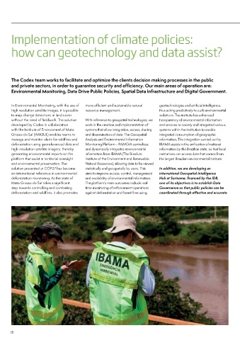
to map change detections in land cover violations. The institute has enhanced
without the need of fieldwork. The solution With reference to geospatial technologies, we transparency of environmental information
developed by Codex in collaboration work in the creation and implementation of and services to society and integrated various
with the Institute of Environment of Mato systems that allow integration, access, sharing systems within the institution to enable
Grosso do Sul (IMASUL) enables teams to and dissemination of data. The Geospatial integrated consumption of geographic
manage and monitor alerts for wildfires and Analysis and Environmental Information information. The integration carried out by
deforestation using georeferenced data and Monitoring Platform � PAMGIA centralizes IBAMA assists in the unification of national
high-resolution satellite imagery, thereby and dynamically integrates environmental information by the Brazilian state, so that local
generating environmental reports on the information from IBAMA (The Brazilian institutions can access data that comes from
platform that assist in territorial oversight Institute of the Environment and Renewable the largest Brazilian environmental institute.
and environmental preservation. The Natural Resources), allowing data to be viewed
solution presented at COP27 has become statistically and geospatially by users. This In addition, we are developing an
an international reference in environmental aims to improve access, control, management international Geospatial Intelligence
deforestation monitoring. As the state of and availability of environmental information. Hub at Suriname, financed by the IDB,
Mato Grosso do Sul takes a significant The platform's main outcomes include real- one of its objectives is to establish Data
step towards controlling and combating time monitoring of enforcement operations Governance so that public policies can be
deforestation and wildfires, it also promotes against deforestation and forest fires using coordinated through effective and accurate
16